

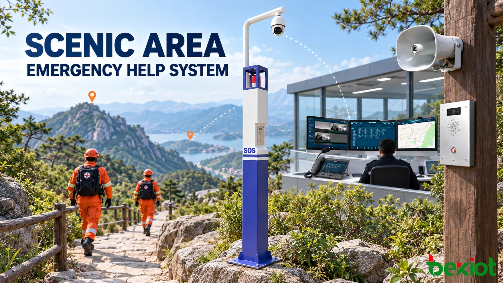
A visitor injured on a mountain path may not know the trail name or nearest access point. A smoke report from a cableway station may need rapid escalation. A scenic area emergency help system gives visitors a defined contact route and helps operators confirm the situation, locate the reported incident and coordinate qualified assistance.
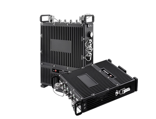
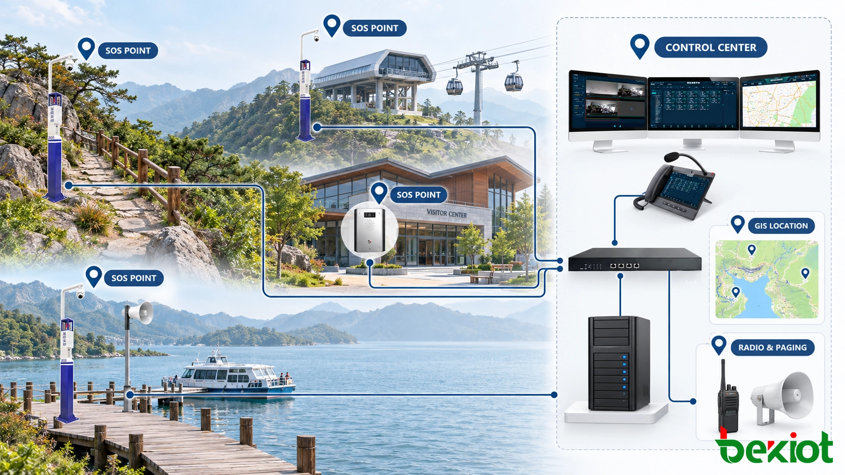
Fixed SOS points can connect with voice services and, through supported integrations, maps, cameras, radio and public address. These are separate capabilities, not automatic consequences of installing a call button. Becke Telcom’s alarm and help-point solutions provide a related system context; the selected configuration and response arrangements require project verification.
Place help points around visitor routes and risks
Start with visitor movements, incident records, terrain and access constraints rather than a universal spacing rule. Consider trail intersections, steep steps, viewing platforms, waterfronts, cableway stations, isolated car parks and areas with unreliable mobile coverage. Staffed entrances and visitor centers may still need clear after-hours arrangements.
Prioritize locations where visitors struggle to find staff or describe their position. A frequently used medical-assistance point may need two-way speech and continuously staffed routing; camera access is optional. Assess whether visitors can approach and use the terminal safely, including people with mobility, hearing, visual or language needs, against applicable local accessibility requirements.
Give every terminal a verified operational identity
“North Trail – Waterfall Junction” is more useful than “SOS 03.” Record coordinates, visible landmarks, trail identifiers, access routes, nearby cameras and the responsible rescue group. State whether access is by vehicle, foot or a restricted service path; a nearby map marker may be separated by a cliff, river or locked gate.
Mapping a fixed endpoint to an installation record is not visitor tracking or live positioning. Confirm where the injured or lost person actually is, especially when another visitor reports from a different location. Update dispatch records, maps, labels and maintenance drawings when routes or installations change.
Match hardware and instructions to the site
Assess rain, condensation, dust, sunlight, temperature, impact and coastal corrosion. Select the actual enclosure, cable entries, mounting and power arrangement from verified specifications. For example, a BHP-SOSA12V SIP video intercom is a product option to assess, not evidence that every help point has the same protection, video or power capabilities.
A clearly marked button, understandable instructions and supported call-status indication help visitors use the point. Test microphone pickup and speaker intelligibility in wind and crowd noise. Distinguish “calling” from “answered” and avoid an indicator that implies a responder has already been dispatched.
Turn the request into an accountable response
A configured platform may display the endpoint name, recorded location and call time when a request arrives. The operator confirms the incident, people involved and immediate hazards, then follows the site plan. Minor injuries, missing children, lost walkers, fire and severe weather require different contacts and escalation.
Keep unanswered requests visible
Define primary and alternate staffed positions, busy handling and an unanswered-call interval. Depending on supported functions, requests may ring additional seats, enter a persistent queue or transfer to a backup center. Verify that identity, location and urgency survive transfers; an on-screen event is not proof that anyone has accepted responsibility.
After-hours routing must match actual staffing. Retain unaccepted and failed calls for follow-up where the platform supports it, with a documented manual procedure if it does not. The scenic-area intercom help architecture explains basic SIP calling; this rescue workflow also addresses terrain, field access and incident ownership.
Use templates as guidance, with human judgment
Templates can present reviewed contacts, questions, radio groups and announcements for medical cases, missing persons, weather, fire or equipment faults. They do not diagnose an injury, infer an emergency from a camera or guarantee rescue. The operator records decisions and escalates to qualified personnel under local procedures.
A fallen tree may initially close one trail; if it blocks an evacuation route, adjacent zones and site management may need notification. Cableway shutdown, trail closure and reopening remain with authorized personnel and the relevant procedures. Communication linkage does not replace the safety controls of transport equipment.
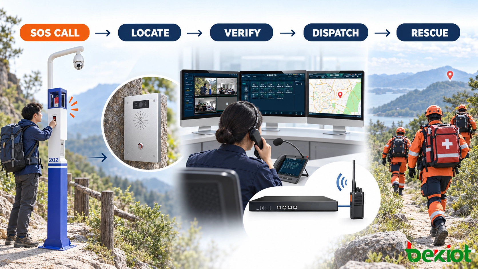
Use video, radio and warnings for distinct tasks
Voice explains what the visitor is experiencing. A supported camera link adds visual context; radio reaches mobile teams; paging warns other visitors. Configure relevant resources rather than making every activation trigger every channel. Continue voice handling when GIS or video is unavailable.
Verify camera associations and rescue access
A cableway entrance may have views of queues, platforms and access roads; a remote trail may have none. Where compatible integration exists, operators can open associated views to check visible crowding, smoke or obstruction. Darkness, rain, vegetation and terrain limit coverage. Do not treat the absence of a visible problem as confirmation of safety.
Maintain camera direction and linkage records after equipment or route changes. Pass the confirmed help-point identity, incident details, number of people and usable access route to the responsible rescue group. Select qualified, available teams; geometric proximity alone does not identify the best responder.
Control radio and telephone coordination
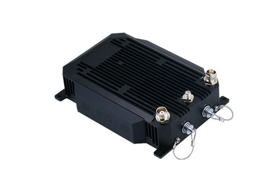
Selected radio channels may connect through a compatible interface or RoIP gateway. Basic audio and PTT do not imply radio identity, location, emergency signaling or talk-group control. Confirm supported functions, field coverage and channel permissions. A temporary conference with a specialist needs controlled participants and release after use.
Plan weather warnings before conditions deteriorate
Zoned paging can warn a closed trail, nearby junctions or shuttle stops without interrupting unrelated areas. Wider emergencies may require approved messages at parking areas, visitor centers and transport stations. Test emergency priority through the complete audio path, including actual loudspeaker output and intelligibility.
Weather plans should identify who monitors conditions, who orders suspension or evacuation, safe destinations, travel time and reopening criteria. The U.S. National Weather Service recommends a lightning safety plan for organized outdoor activities. Do not direct visitors to an exposed SOS pole or assume that a small rain shelter provides lightning protection; use locally approved safe-shelter instructions.
Design remote communications around shared failures
Fiber or Ethernet may serve buildings; remote points may need wireless bridges or cellular links. Survey terrain, seasonal vegetation, weather exposure and peak visitor loading. Digital radio supports field teams only where the system provides usable coverage. A different transmission technology does not by itself create an independent backup.
Verify continuity across the whole path
Review servers, databases, switches, gateways, wireless sites, consoles, power, authentication and time services. Two uplinks may share a tower, backhaul, duct or power supply. An alternate answering center may still depend on the failed local connection. Document failure independence and test the intended degraded service, including new calls and active-call interruption.
Remote zones may need an approved local warning method or independent radio access. Local controllers, fallback calling and backup power are configuration-dependent; define who operates them and how authority returns after recovery. No architecture guarantees communication in every disaster.
Size power for all remote equipment
Use PoE only where the terminal, switch, power budget and cable limits support it. Other points may use mains, solar and battery arrangements. Include cameras, wireless equipment, heaters and loudspeakers in the load calculation, with temperature, battery aging and expected outage duration. Monitor low voltage and charging faults only where supported, and inspect physically.
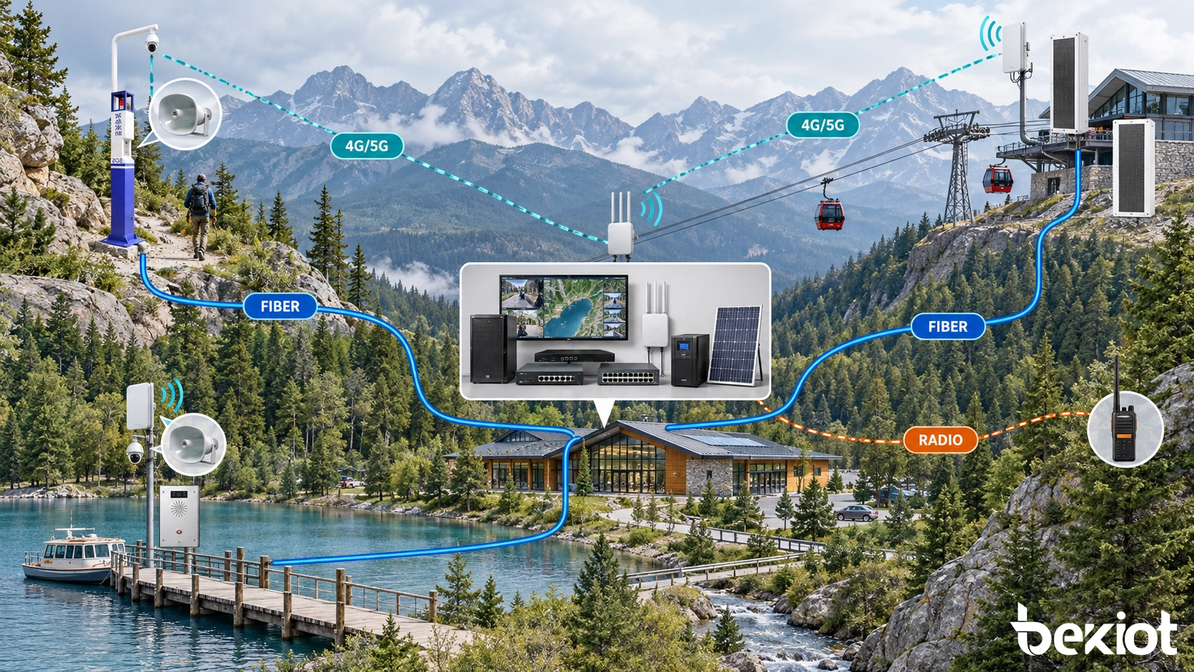
Protect records and maintain the installed help points
Separate visitor-service, security, rescue, maintenance and administration permissions. Record the initial request, location evidence, owner, contacts, warnings and outcome where supported. Distinguish call answer, team dispatch, arrival and closure; these are different milestones. Patterns of repeated calls can reveal confusing signs or access problems.
Recording and video retention depend on applicable law and site policy. Define notice, authorized access, retention, export and deletion without assuming a universal recording obligation. Protect personal and medical information and limit the sharing of visitor locations to the response purpose.
An online icon does not prove a working button, microphone or loudspeaker. Inspect labels, enclosure, cable entries, mounting, power and the physical approach. Make test calls, check two-way speech, verify the map and camera associations, and set inspection intervals according to exposure, visitor volume and risk.
Test the visitor-to-rescue chain before opening
Call from busy entrances, exposed platforms, remote trails and transport stations using complete spoken instructions under representative noise.
Check button operation, call-status indication, recorded location, staffed answer, busy handling and unanswered escalation.
Confirm field radio coverage, the selected camera and paging zone, emergency audio priority and manual handling without maps or video.
Exercise simultaneous incidents, server or link loss, power interruption, local fallback, recovery and unfinished-event handover.
Handover should include endpoint identities, coordinates, route descriptions, addresses, power sources, cameras, radio groups, warning zones, escalation contacts and configuration ownership. Record measured limitations and degraded functions. An SOS installation supplements visitor preparation, route information and emergency plans; it does not replace them or guarantee a response time.
FAQs
Can existing analog call points be reused?
A compatible powered gateway may support reuse. Check electrical interfaces, identity mapping, button behavior, speech, cable condition and fault reporting, then test the complete route to the operator.
How much simultaneous-call capacity is needed?
Assess peak visitation, risk scenarios and staffing together with voice, video, radio and paging capacity. Test several unrelated calls so operators can distinguish, prioritize and assign incidents without losing unanswered requests.
How should accidental activations be handled?
Verify the situation and record an appropriate outcome. Repeated accidental calls can indicate unclear instructions, poor placement or damage; review the cause instead of disabling a necessary help point.
Can the system expand to new trails?
Expansion may be possible with compatible equipment and adequate licenses, network, power and staffing. Survey the new route, assign rescue responsibility, update location and access records and repeat acceptance tests before opening.
References
The National Park Service Trip Planning Guide discusses changing terrain, weather, communications limits and visitor emergency planning. The National Weather Service lightning guidance addresses designated decision-makers and safe shelter. These are planning references, not certification of a help-point system.